

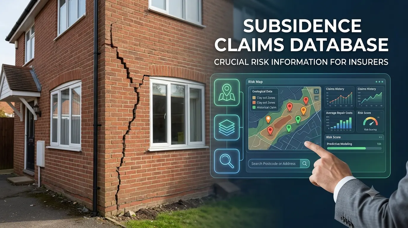
Ground movement is one of the most destructive and financially crippling hazards a property owner can face. When soil shifts, shrinks, or collapses beneath a foundation, the structural integrity of the entire building is compromised. For insurance underwriters, risk assessors, and prospective property buyers, understanding the historical likelihood of ground movement in a specific area is vital.
This is where a subsidence claims database becomes indispensable. By consolidating decades of historical claims, geological surveys, and environmental data into a single, searchable repository, industry professionals can accurately evaluate risk, price insurance policies fairly, and protect long-term property investments.
What Is a Subsidence Claims Database?
A subsidence claims database is a specialized risk-management platform designed to track, store, and analyze historical records of property damage caused by ground movement. Unlike general property registers, this database focuses specifically on events where soil displacement—whether from clay shrinkage, tree root ingress, abandoned mine shafts, or leaking water mains—has triggered structural insurance claims.
By aggregating records across postcodes, street addresses, and individual properties, the database provides a clear picture of localized geological vulnerability.
How Ground Movement Data Is Collected and Standardized
To maintain accuracy, data is continually gathered from multiple sources, including insurance claims departments, loss adjusters, structural engineering reports, and national geological surveys.
When a policyholder files a claim for foundation cracking or wall movement, the incident details are processed and logged into the system. Standardized metrics—such as the date of movement, severity of structural damage, soil type (e.g., highly reactive clay vs. stable bedrock), and total repair costs—are recorded to ensure consistent evaluation across different regions.
Why Insurers Depend on Historical Subsidence Claims Data
Insurance companies operate on probability and risk distribution. Subsidence is notoriously difficult to predict on a house-by-house basis without granular historical context. A property located on a street with no prior history of ground movement presents a vastly different risk profile than a neighboring home built over an active clay belt during a severe drought year.
Without access to a centralized subsidence claims database, underwriters would be forced to rely on broad, regional estimates, leading to inaccurate policy pricing and potential financial losses.
Assessing Soil Vulnerability and Environmental Triggers
Soil type is the primary factor driving ground instability. Highly expansive clay soils swell when saturated and shrink significantly during dry summers. When prolonged heatwaves occur, entire neighborhoods built on clay can experience simultaneous foundation settling.
By analyzing historical trends within the database, insurers can correlate spike years in claims with specific weather patterns, allowing them to adjust pricing models dynamically before new weather extremes occur.
Core Features of an Effective Claims Tracking Platform
Modern risk management platforms go far beyond basic spreadsheets. A comprehensive subsidence claims database integrates advanced data visualization, GIS (Geographic Information System) mapping, and automated reporting toolkits to give property analysts actionable insights in seconds.
Geospatial Integration and Historical Property Mapping
Geospatial mapping allows users to overlay historical claim points directly onto interactive geological maps. Analysts can visually inspect high-density claim clusters, measure distances from known hazard zones (such as historic mining sites or ancient riverbeds), and evaluate the proximity of mature trees known for aggressive water absorption.
| Feature | Description | Practical Benefit for Users |
| GIS Mapping Overlay | Visualizes historical claim locations over soil and geological maps. | Quickly identifies high-risk clusters down to individual street levels. |
| Claim Severity Indexing | Categorizes historical claims by dollar value and repair scope (e.g., underpinning vs. cosmetic repair). | Helps insurers set accurate policy deductibles and coverage limits. |
| Environmental Correlation | Links past claims to historical climate data and tree proximity records. | Improves predictive accuracy for seasonal weather events. |
| Automated Address Matching | Instantly cross-references new policy applications against known historical claims. | Streamlines property underwriting and reduces manual review times. |
Impact on Property Valuation and Homeowner Insurance Premiums
A history of structural movement can drastically affect a property’s market value and insurability. When a property has undergone past repairs—such as underpinning—insurers require clear documentation before issuing a policy.
If a home sits within a zone flagged by a subsidence claims database, insurance companies may apply specialized terms, such as higher excess fees for ground movement claims or mandatory pre-underwriting structural surveys.
Navigating High-Deductible Policies and Underwriting Decisions
For homeowners, finding out that a property sits in a high-risk sector can be discouraging. However, data transparency ultimately protects buyers. When underwriters have access to detailed historical records showing that a prior claim was resolved through proper engineering interventions (e.g., repairing a leaking drain or removing a problematic tree), they are more likely to offer fair coverage rather than outright denying protection.
Key Takeaway: A flagged location in a claims database does not automatically render a home uninsurable; rather, it prompts underwriters to request targeted engineering proof that the underlying cause of movement has been rectified.
Modern Innovations: Predictive Analytics and Climate Modeling
As climate patterns fluctuate and long dry periods become more frequent, relying solely on past data is no longer sufficient. Modern platforms are integrating artificial intelligence and machine learning algorithms to transform static historical records into dynamic predictive tools.
Shifting from Reactive Claims Tracking to Proactive Risk Reduction
By combining historical claims logs with real-time satellite radar data (InSAR) that measures millimeter-level ground displacement, modern databases can highlight areas actively experiencing subtle ground shifts before structural cracking even appears.
| Criteria | Traditional Claims Database | Next-Gen Predictive Analytics System |
| Data Reliance | Historical claims and past structural reports. | Real-time satellite imagery, soil moisture sensors, and AI modeling. |
| Risk Detection | Reactive (identifies risk after damage occurs). | Proactive (identifies ground movement before visible damage appears). |
| Mapping Resolution | Postcode or neighborhood level. | Property-specific and foundation-level monitoring. |
| Climate Adaptability | Static historical averages. | Dynamic scenario modeling for future heatwaves and rainfall patterns. |
How Homebuyers and Conveyancers Can Leverage Claims Data
It is not just insurance companies that benefit from structured claim tracking. Real estate conveyancers, mortgage lenders, and property buyers increasingly rely on reports derived from a subsidence claims database during the due diligence phase of a property purchase.
Preventing Costly Mistakes During Property Acquisition
Discovering unmanaged ground movement after completing a property purchase can lead to hundreds of thousands of dollars in repairs and uninsurable real estate. Ordering a comprehensive environmental and subsidence search early in the conveyancing process ensures buyers are fully aware of:
-
Past claims filed on the specific property or immediate neighbors.
-
The specific soil composition beneath the foundations.
-
Local geological hazards such as historic mining, chalk pits, or coastal erosion.
-
Recommendations for specialized structural surveys prior to finalizing contract exchanges.
Conclusion
A subsidence claims database serves as a vital bridge between historical geological events and modern property risk management. By transforming complex geological data and historical insurance records into clear, actionable intelligence, these databases protect insurers from unquantified risk and empower homebuyers to make informed decisions. As predictive technologies and climate modeling continue to evolve, access to accurate ground movement data will remain the cornerstone of resilient property underwriting and real estate management.
Frequently Asked Questions (FAQs)
1. How does a property get listed in a subsidence claims database?
A property is typically listed when an official insurance claim for ground movement, structural settling, or heave is filed with an insurer and processed through industry-standard reporting networks.
2. Can I remove my property from a subsidence claims database if repairs are complete?
No, historical claim records remain in the database as a factual record of ground movement history. However, you can add structural certificates, loss adjuster sign-offs, and engineering reports confirming that repair work (like underpinning or tree removal) successfully stabilized the foundation.
3. Does a nearby claim on my street automatically raise my insurance premium?
Not necessarily. While living in a high-risk postcode flagged by a subsidence claims database can influence baseline rates, underwriters evaluate individual risk factors—such as your home’s foundation type, age, distance from trees, and specific site geology—before adjusting premiums.
4. What is the difference between settlement and subsidence in claims data?
Settlement refers to a building naturally sinking into soil under its own weight shortly after construction. Subsidence occurs when the ground beneath a building shifts due to external factors (like soil shrinkage, leaking drains, or roots) displacing an established foundation.
5. How far back do subsidence claims database records go?
Most comprehensive databases maintain records spanning several decades, often correlating data from major historic drought events alongside recent claim filings.